SITECH UK & Ireland, a leading distributor of Trimble machine control technology for the civil and heavy construction industry, now offers the TDC600, an easy-to use handheld controller that allows contractors to retrieve and analyse highly accurate spatial information.
The Trimble TDC600 Handheld is a rugged and lightweight device suitable for managing global navigation satellite system (GNSS) data. The device enables operators to monitor real-time cut/fill information, make design changes while in the field and manage their 3D datasets more effectively.
The TDC600 provides contractors with access to up-to-date site data, which can be communicated with colleagues working in site offices, so teams can more easily coordinate to prevent misalignment between design and operational delivery. The device also means that contractors can track progress more effectively and respond to design changes in real-time without having to go back to the project’s draftsman.
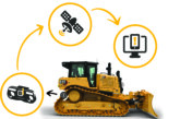
Operators can use the TDC600 to feed design changes from the field, to the truck cab, and back to the office. This means they can more efficiently while surveying, taking stockpile measurements and carrying out grade verification. Contractors can receive on-the-spot approvals even when the team is split across different areas. Its lightweight design, large capacity and replaceable battery means that the operator can use the controller throughout the day without experiencing fatigue or battery failure.
“Miscommunication is one of the biggest challenges facing construction businesses and, when designs are misinterpreted, it causes confusion and increases costs,” explained Ian Barnes, Head of Business at SITECH UK & IRELAND. “Trimble’s new controller is Wi-fi and Bluetooth-enabled, allowing the user to synchronise design and field data via the internet and share it in real-time. With built-in front and rear-facing cameras, operators can also video conference from the field and capture high definition videos and images.
“This new controller is compatible with Trimble’s Siteworks software, meaning multiple operators can access the same data from a single platform,” continued Barnes. It can help them to bridge any information gaps and minimise confusion by accurately measuring and verifying original ground levels, information on cut/fill and other data.”


